DRF vision will not be limited to drones, in theory it could work even for large aircraft at high altitudes.
Let’s say that at some point you feel the need to go to a place that has sunshine and sit under the sun to read a book or just have a cocktail. What you would do, first of all, would be to check the weather of your favorite areas on your smartphone to see the forecast for the next few hours.
In case the weather in the area you want to go is unstable for a few hours, you will do some other activity, until the weather changes for the better and the sun rises again, so that you are there at the right time.
In essence, you searched for information, gathered it, decided what it meant, “weighed” your choices, and finally made your final decision. The data you needed was available and you did all the reasoning.
But what if you had a device that would do all this process for you, to notify you in case there is an issue that requires your attention? And consider, “you” may not be you, but a flying cargo drone flying to an urban center!

NASA Data and Reasoning Fabric
This feature, described above, is the general idea behind NASA ‘s DRF project .
Data and Reasoning Fabric is a project being developed by NASA that examines the possibility of creating an advanced information infrastructure that will be able to connect and provide useful information to autonomous vehicles in real time .
The foundations of the “smart” city of the future
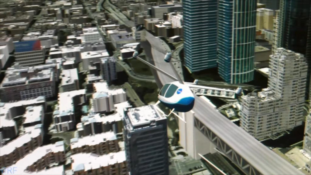
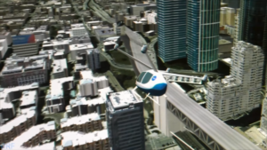
For example, in the not-too-distant future, an autonomous, flying drone will carry products, transport people from one place to another, perhaps help detect fires and do so many other things that at the moment we can not even imagine we can.
To be able to successfully and safely complete these flights, the drone will have to rely on this new feature, that is, to be able to receive important information during his flight , such as extraordinary changes in weather conditions, which could make his flight difficult, giving him the option to change course.
To be able to give these eVTOLs all this useful information, NASA’s innovative aeronautics are experimenting with what they call “Edge Nodes” .
Mot General Motors is designing an autonomous electric vehicle for astronauts on the Moon
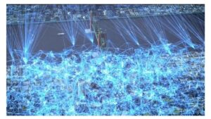
“Edge Nodes” are devices, such as our well-known routers, that will be part of a larger “grid” of connected computers that will send accurate information related to the air traffic of each drone in real time, wherever are found!
This infrastructure will be what some call the “smart” city of the future.
The key element of this new NASA project is “Edge Nodes” , which will contribute significantly to his vision DRF. The task of these “nodes” will not only be the transfer of data, but also their analysis. This is the general “reasoning” behind it Data and Reasoning Fabric .
The “Edge Nodes” will work automatically. They will have access to data, translate it into useful information and update the drones. The nearest “Joint Hub” will send to the autonomous, flying vehicle specific information about its flight and instructions regarding the “smart” city.
Where will the data be collected from?
One question that arises is where all this data will be collected and how it will be accessible.
DRF envisions a digital “market” in which various providers, such as weather forecasting services, map services, research companies, air traffic services and others, will offer the data available to companies using drones, via digital agreements.
In return, the companies that will use this information will in turn share the data they have collected from their drone flights.
For example, a drone transporting goods is ordered to make a delivery to an area in the center of a large city. Connects to Data and Reasoning Fabric.
The nearest “Tip Hub” provides the drone with weather information in the area, an accurate map of the area by the competent authorities, as well as possible nearby flights of other aircraft, to avoid collisions, which will be provided by the local air service traffic.
All this information will be gathered from the agreements concluded between all market participants.
Upon receiving the information, the drone will realize whether the weather is good or not, one will have to fly higher or lower than the usual flight altitude, due to possible heavy air traffic in the area and much more.
In addition, the drone will learn to avoid accidental obstacles, while any new information will be transferred to the system and can be used by another drone that will fly in the area at the same time or later.
If everything works properly with the execution of DRF the drones will have all the necessary information to perform the safest and most economical route, with the least required human presence.
DRF vision will not be limited to drones, in theory it could work even for large aircraft at high altitudes.
Source: idrones.gr